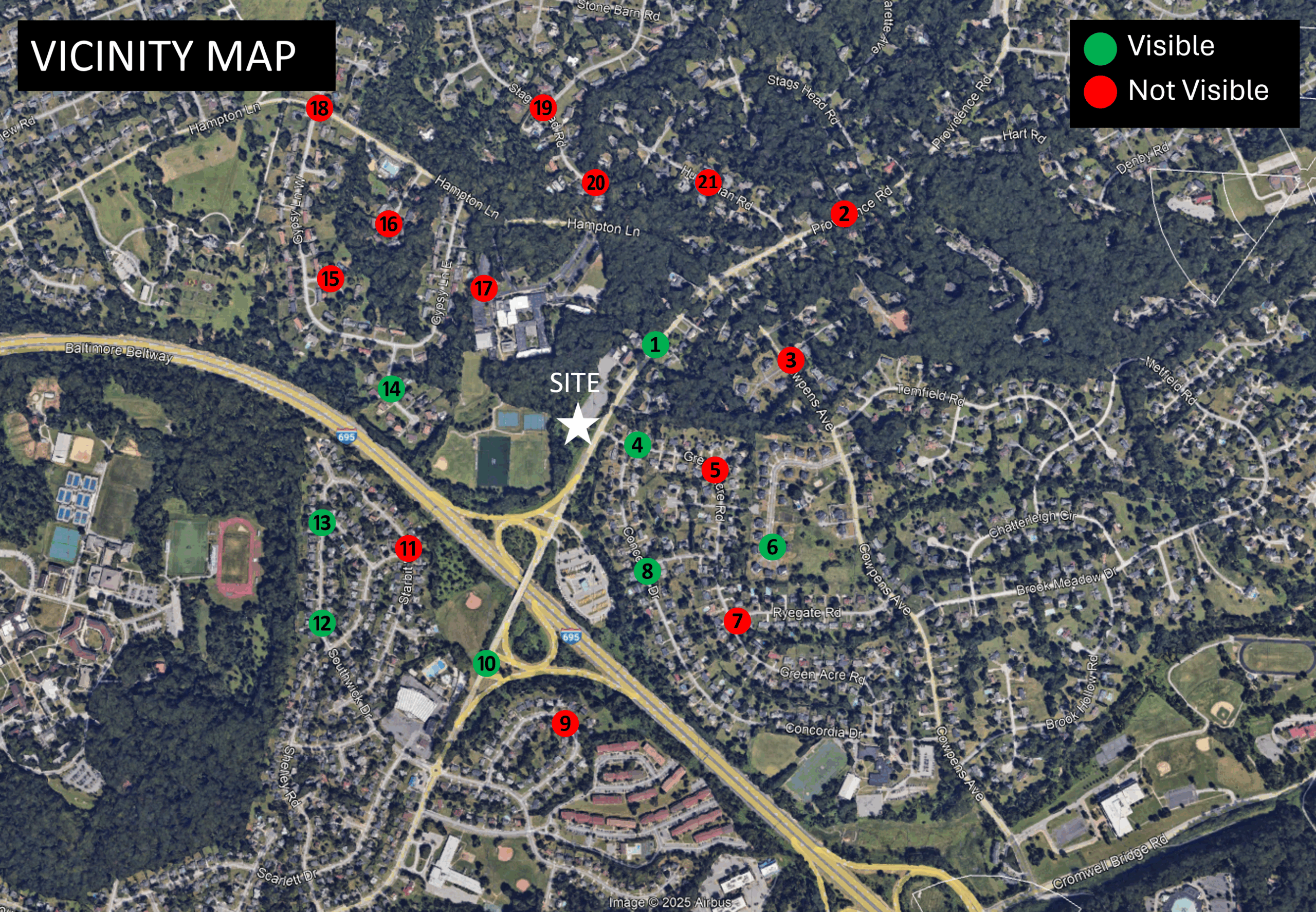
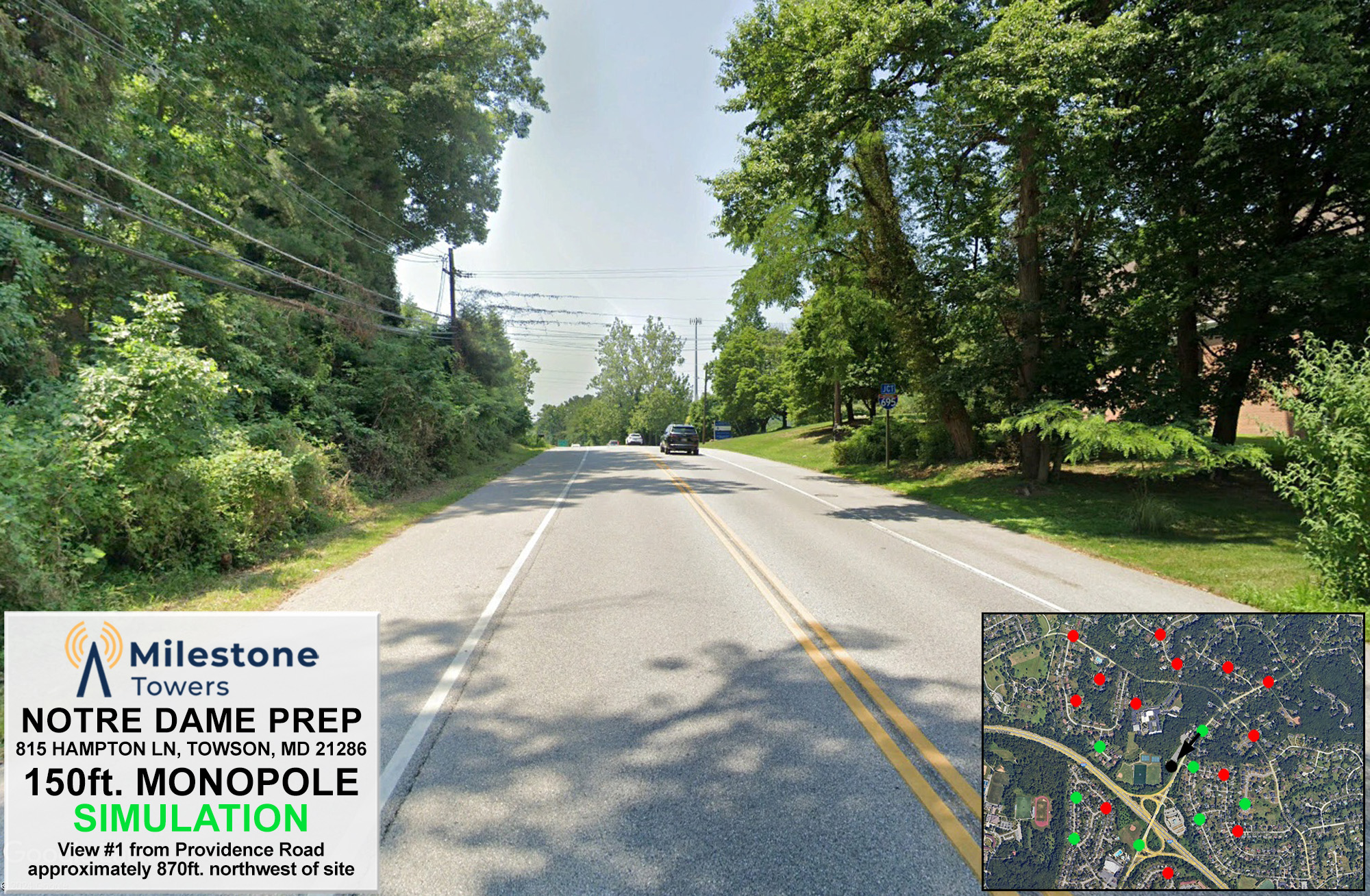
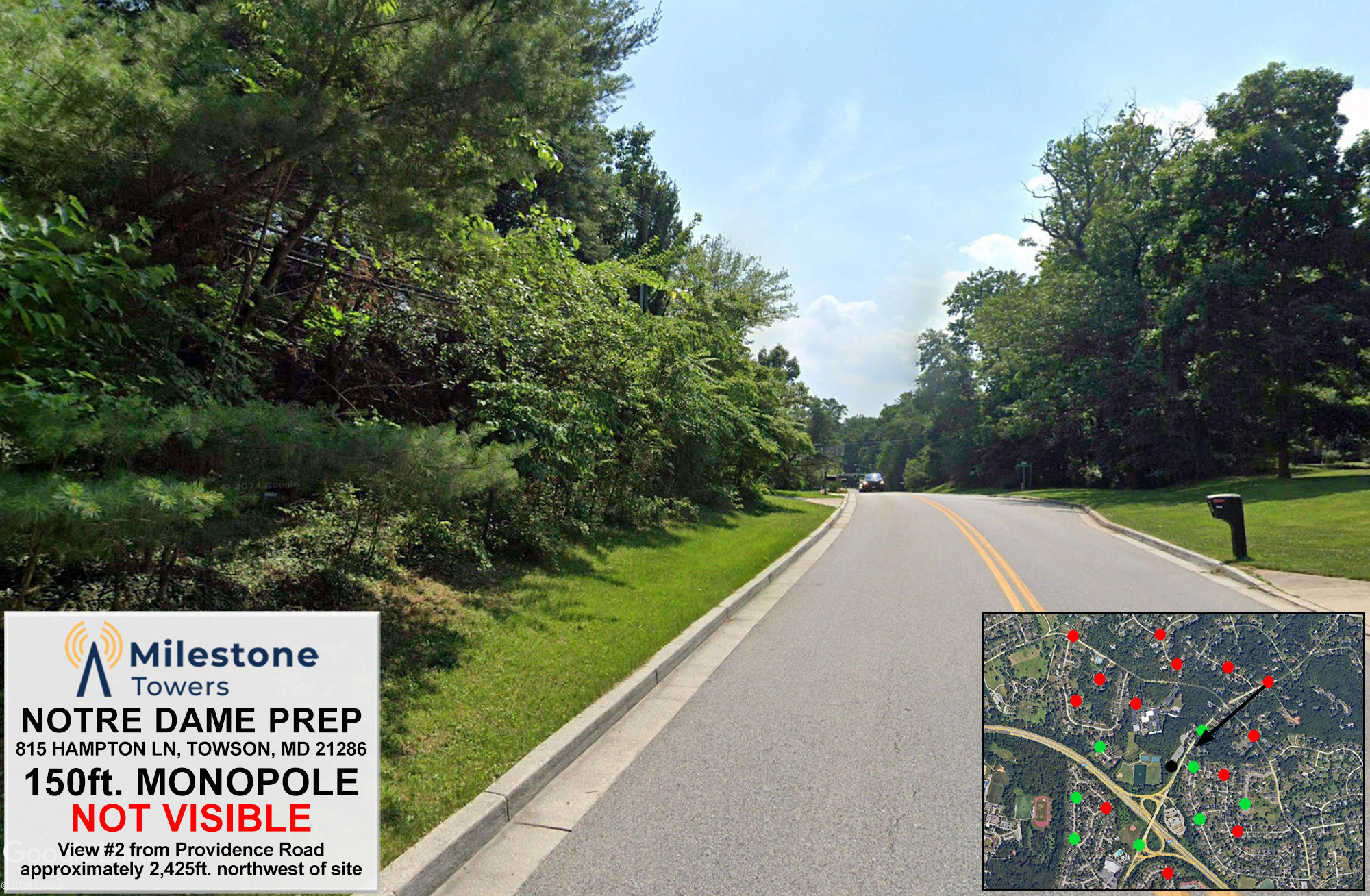
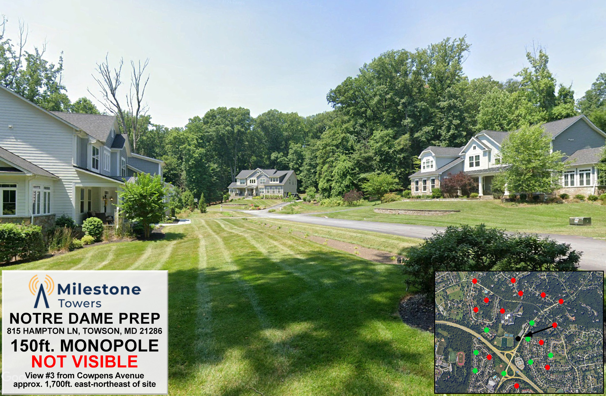
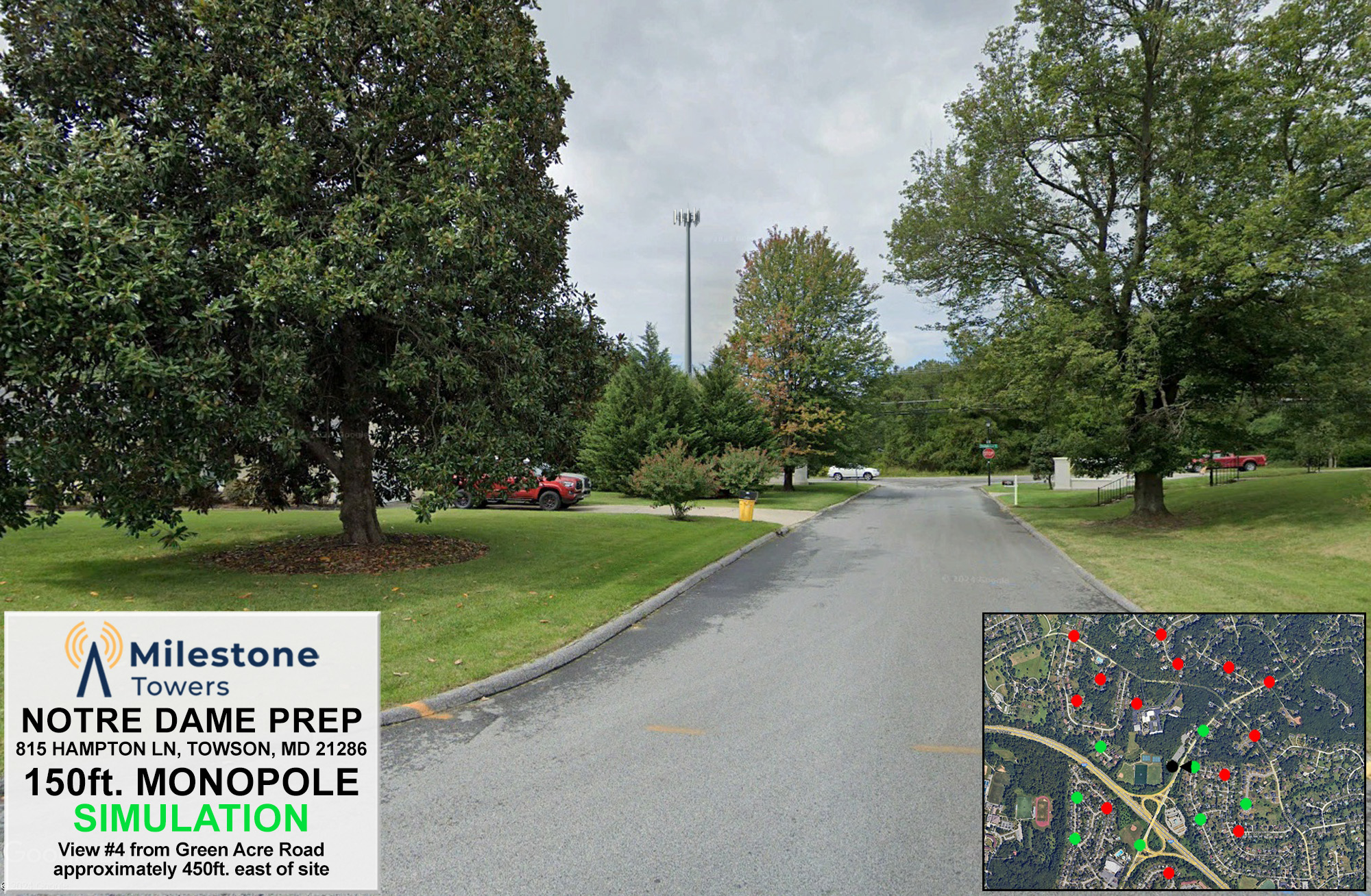
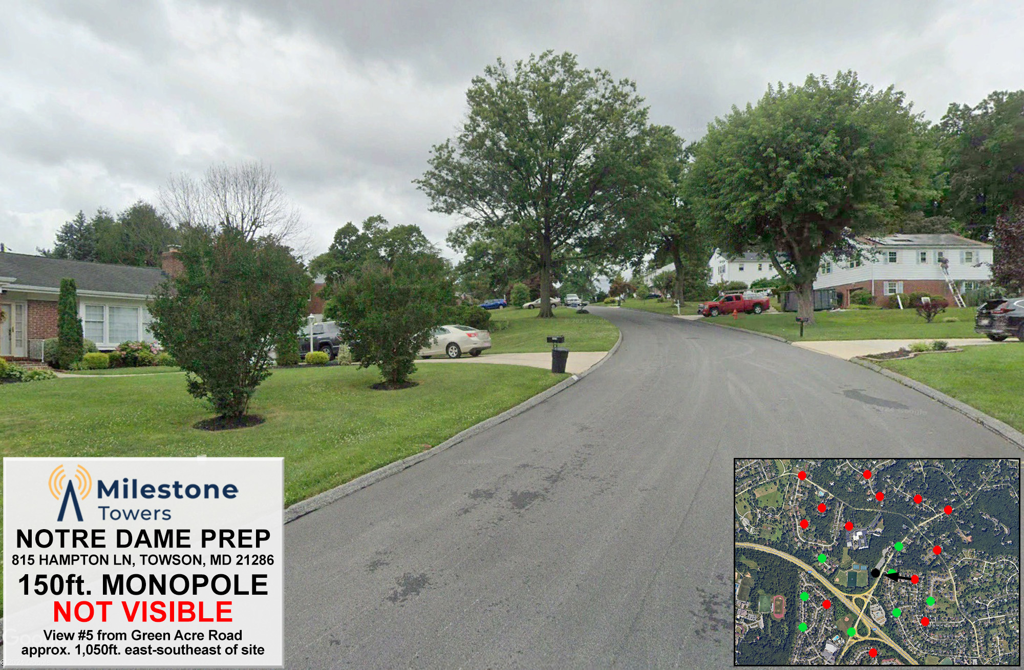
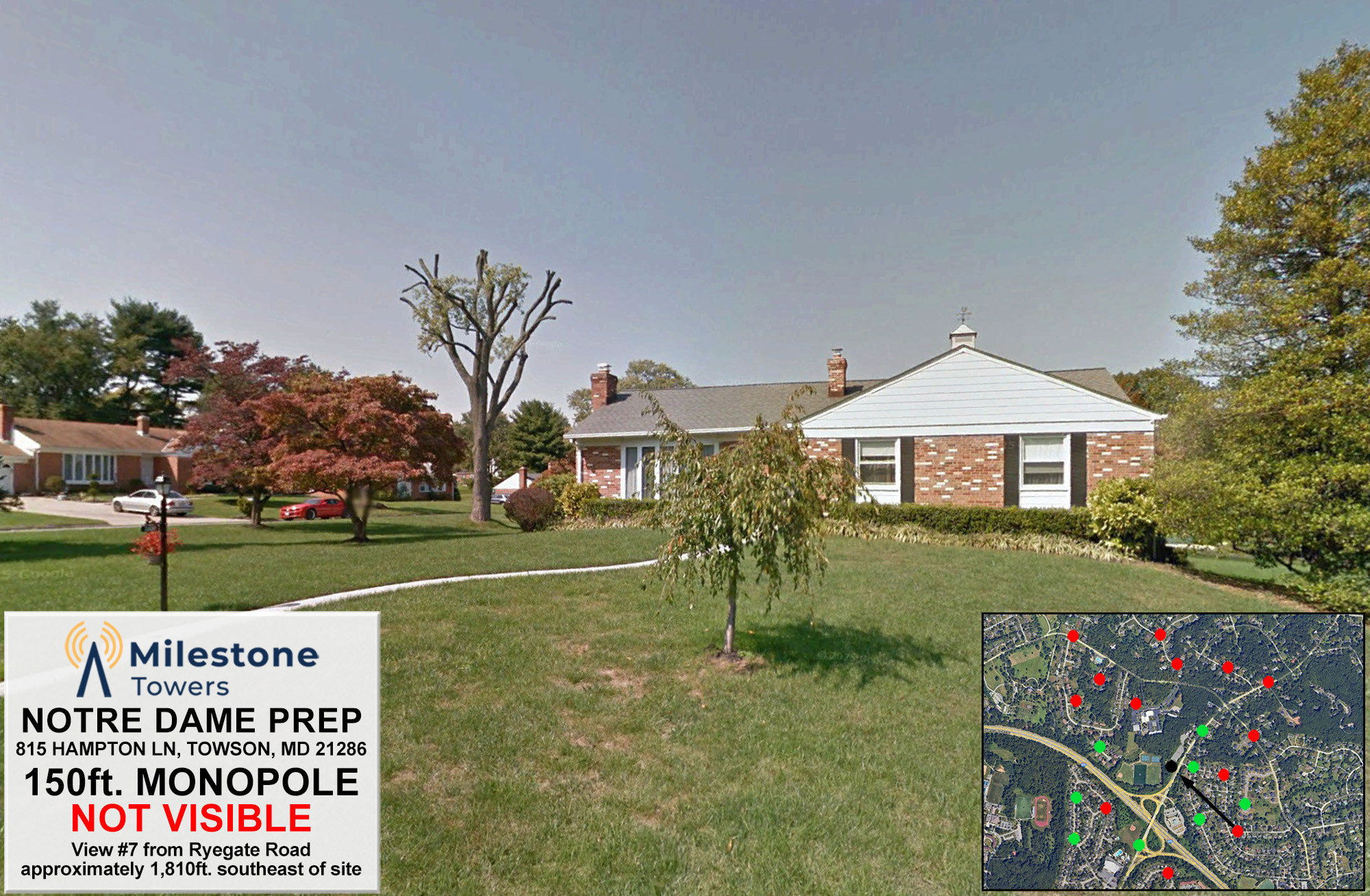
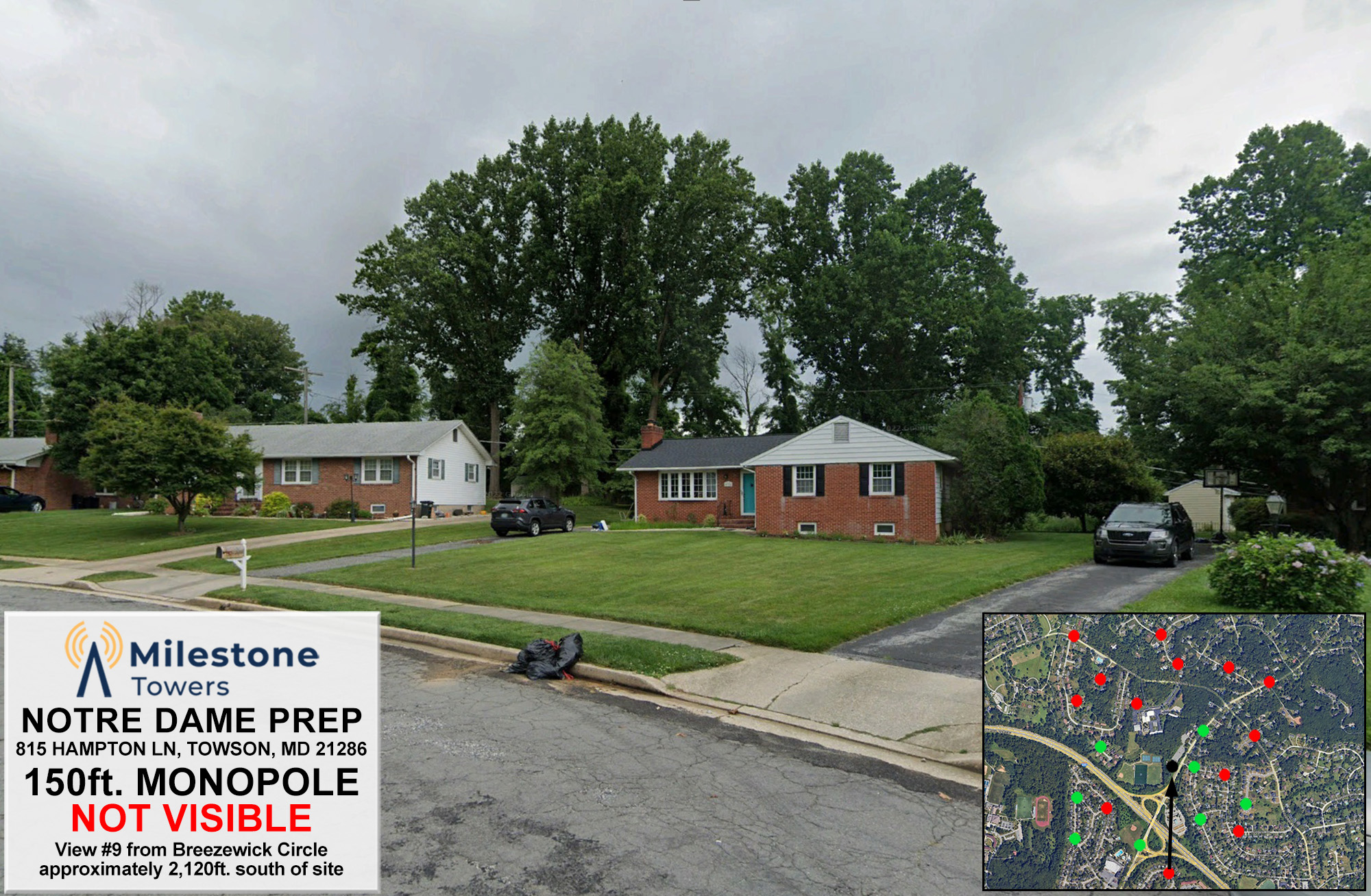
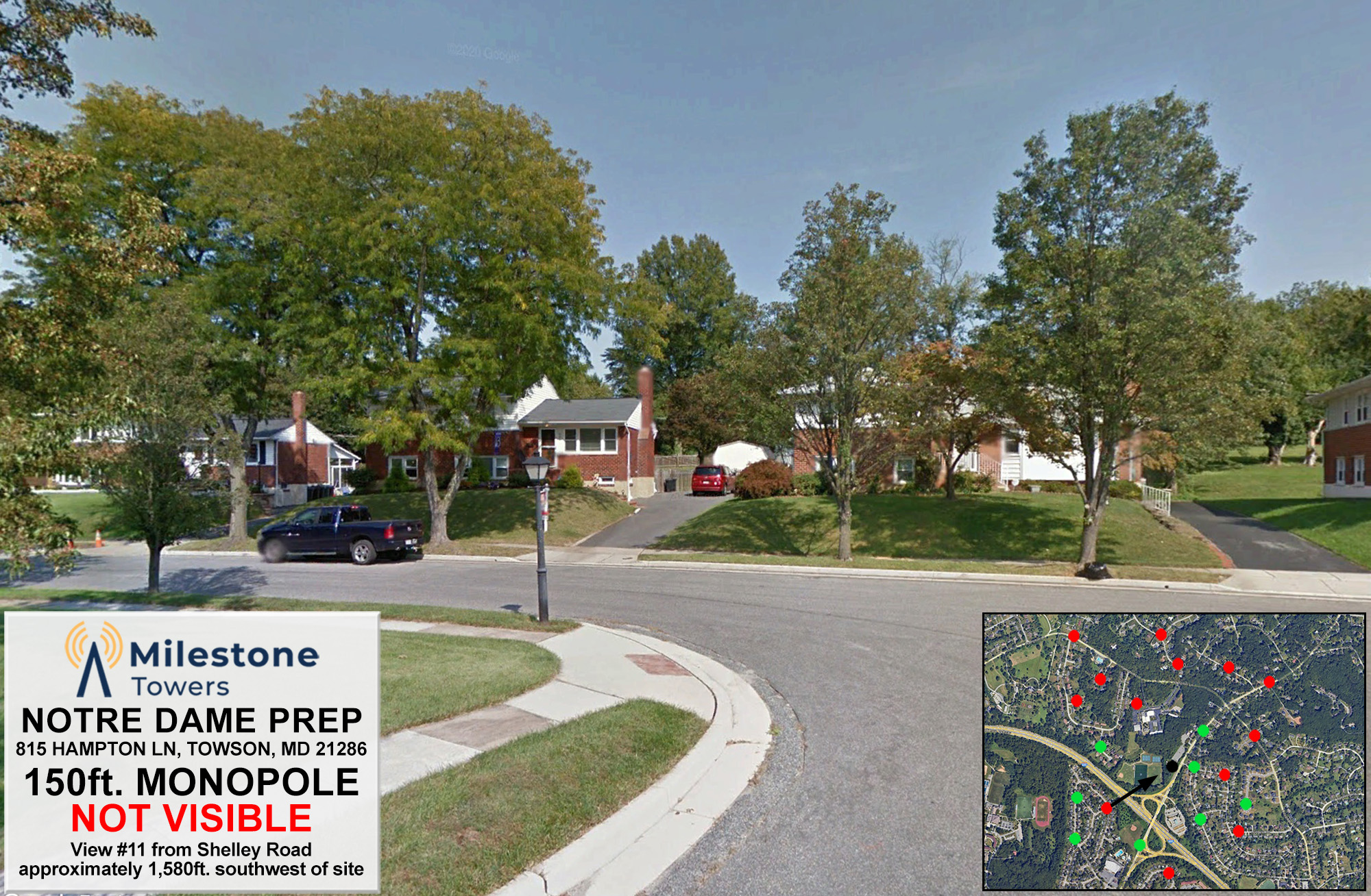
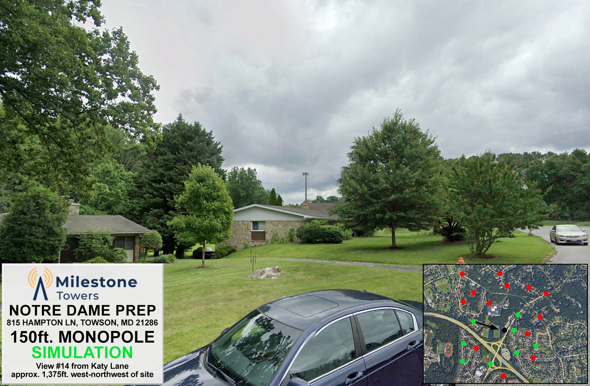
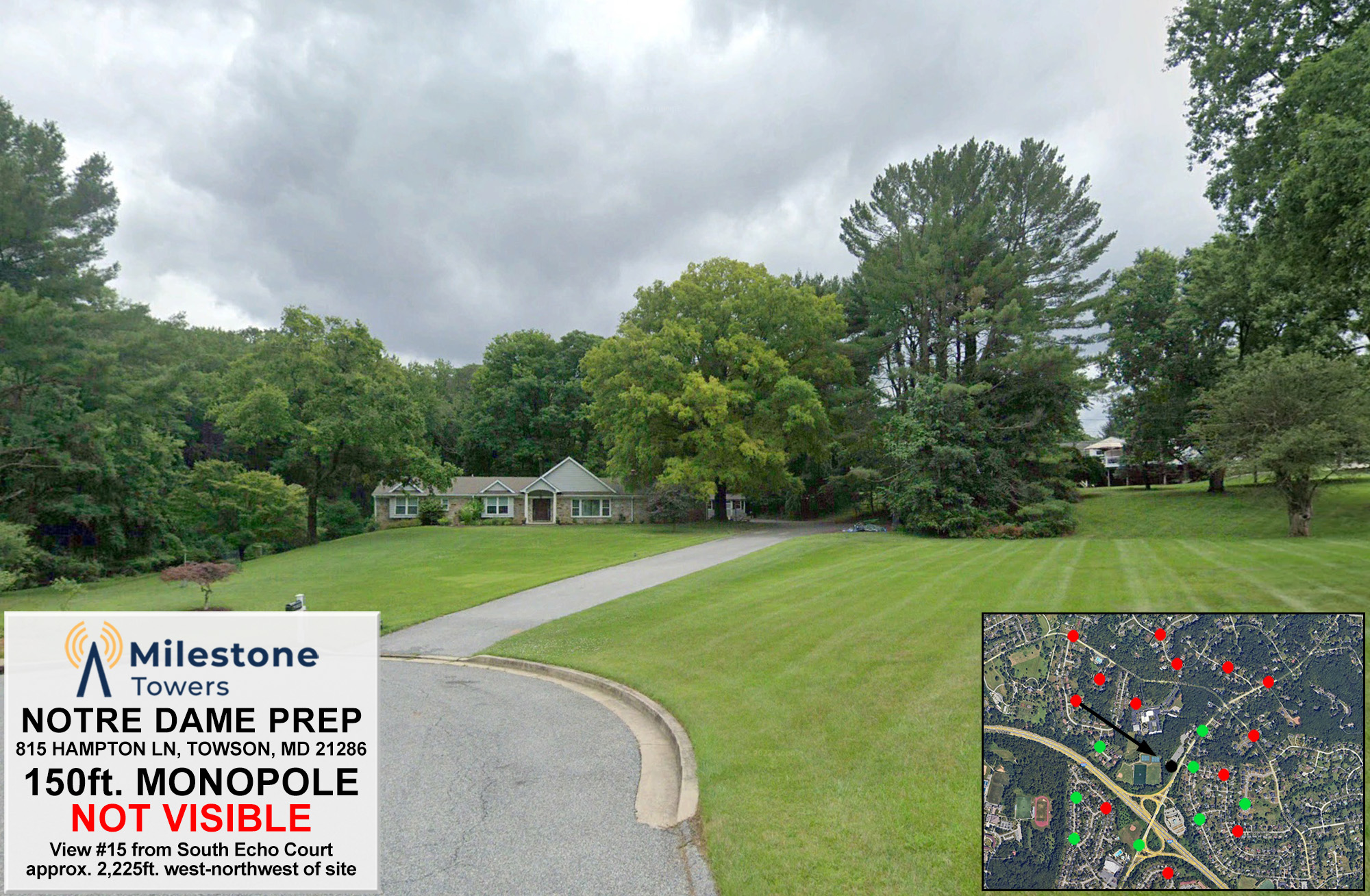
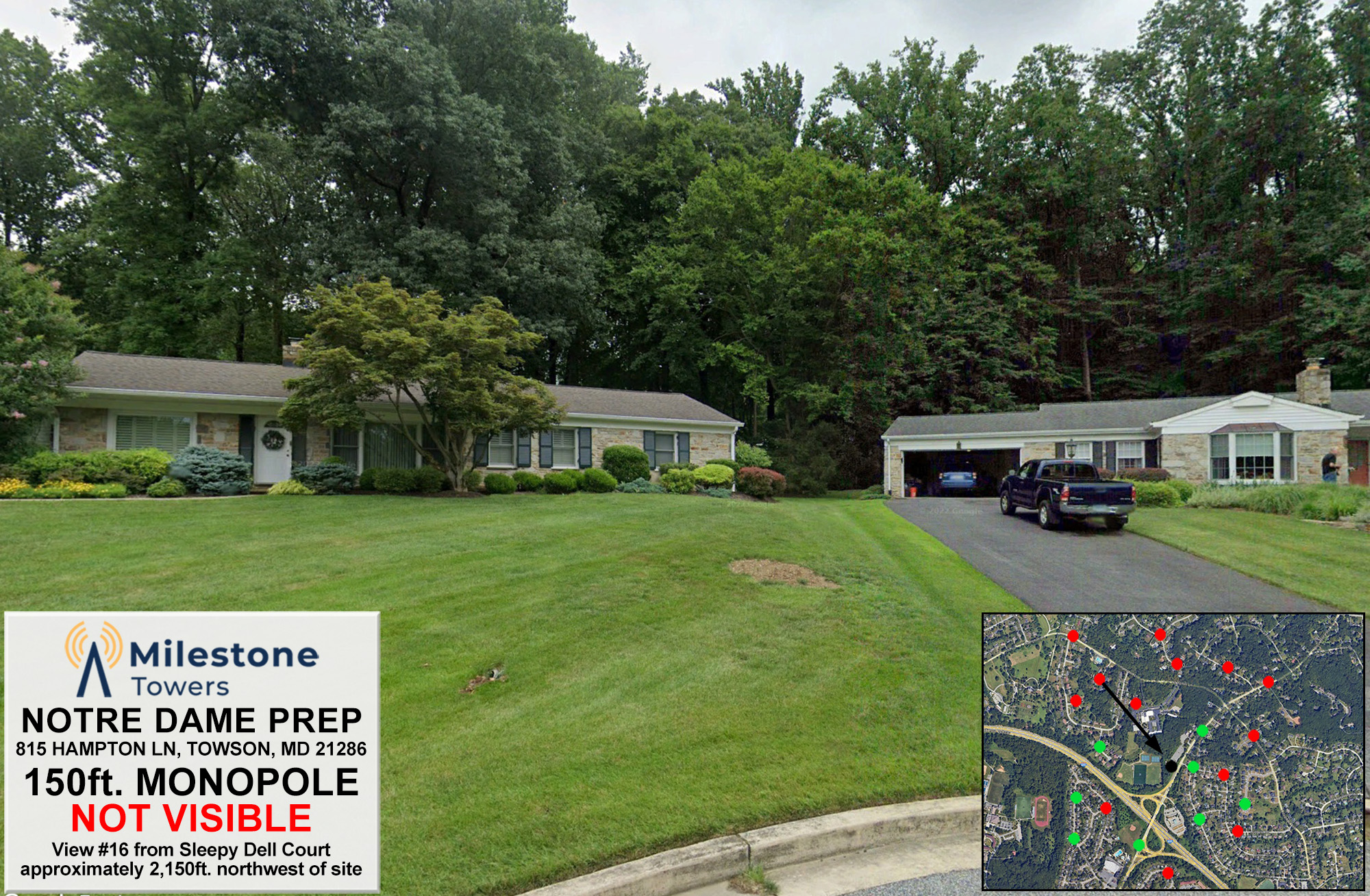
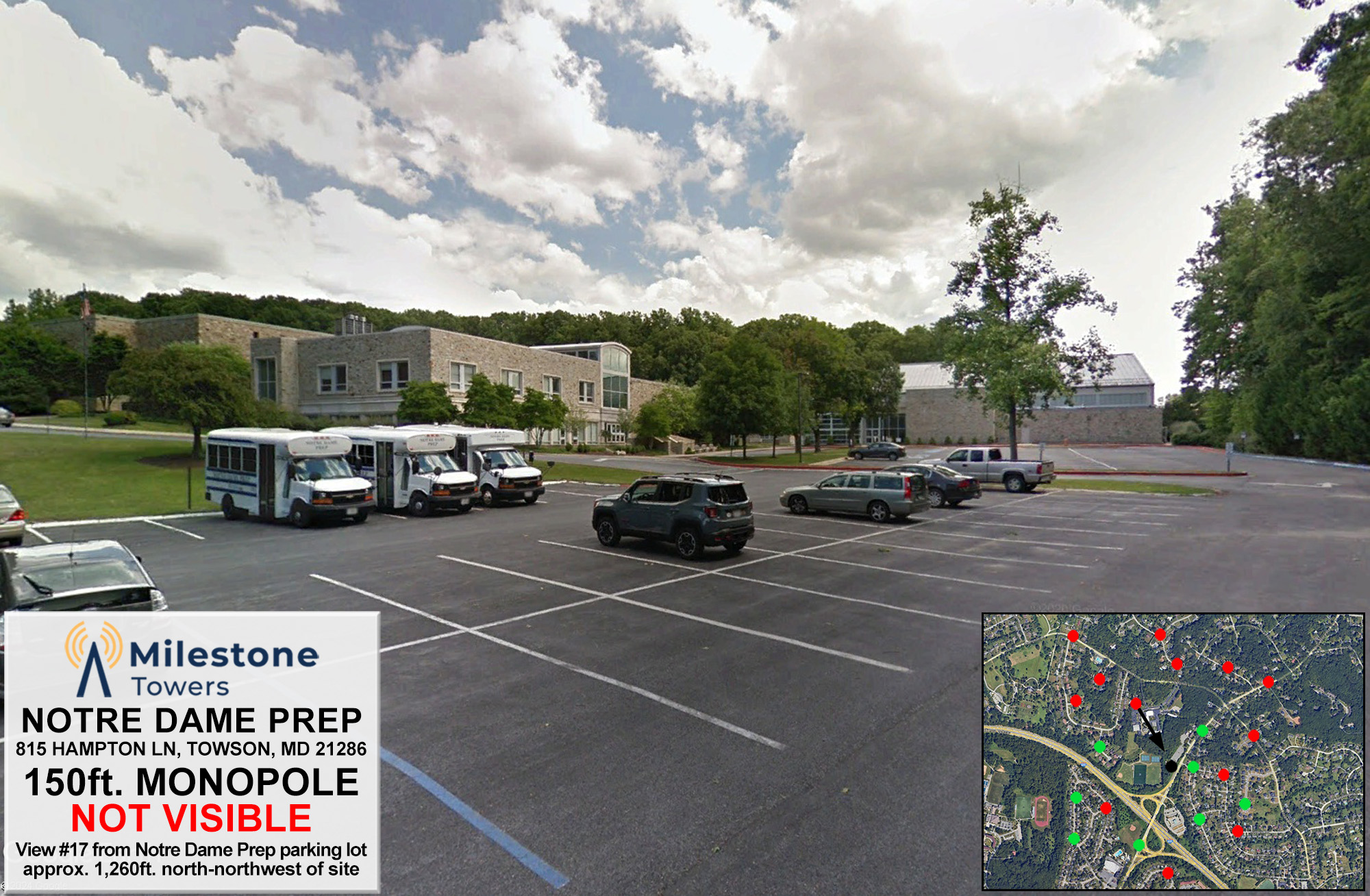
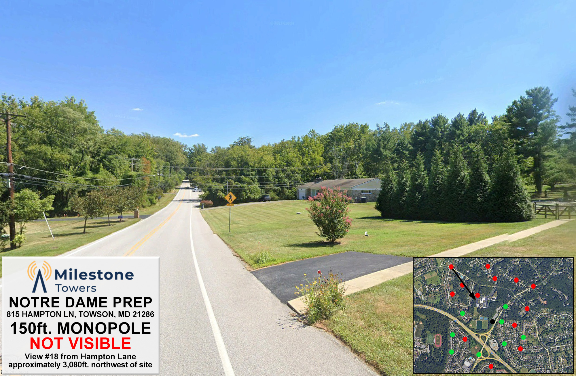
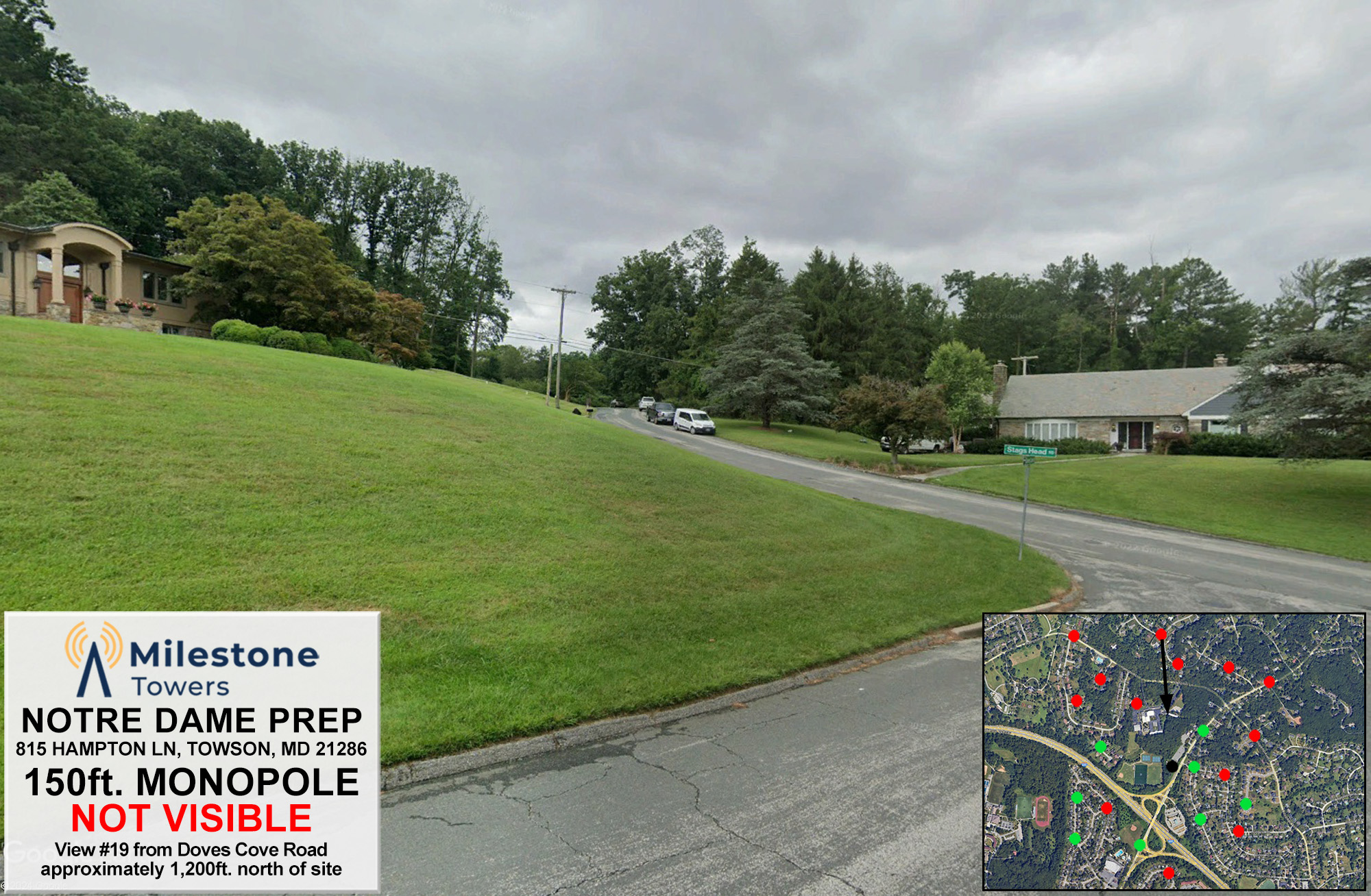
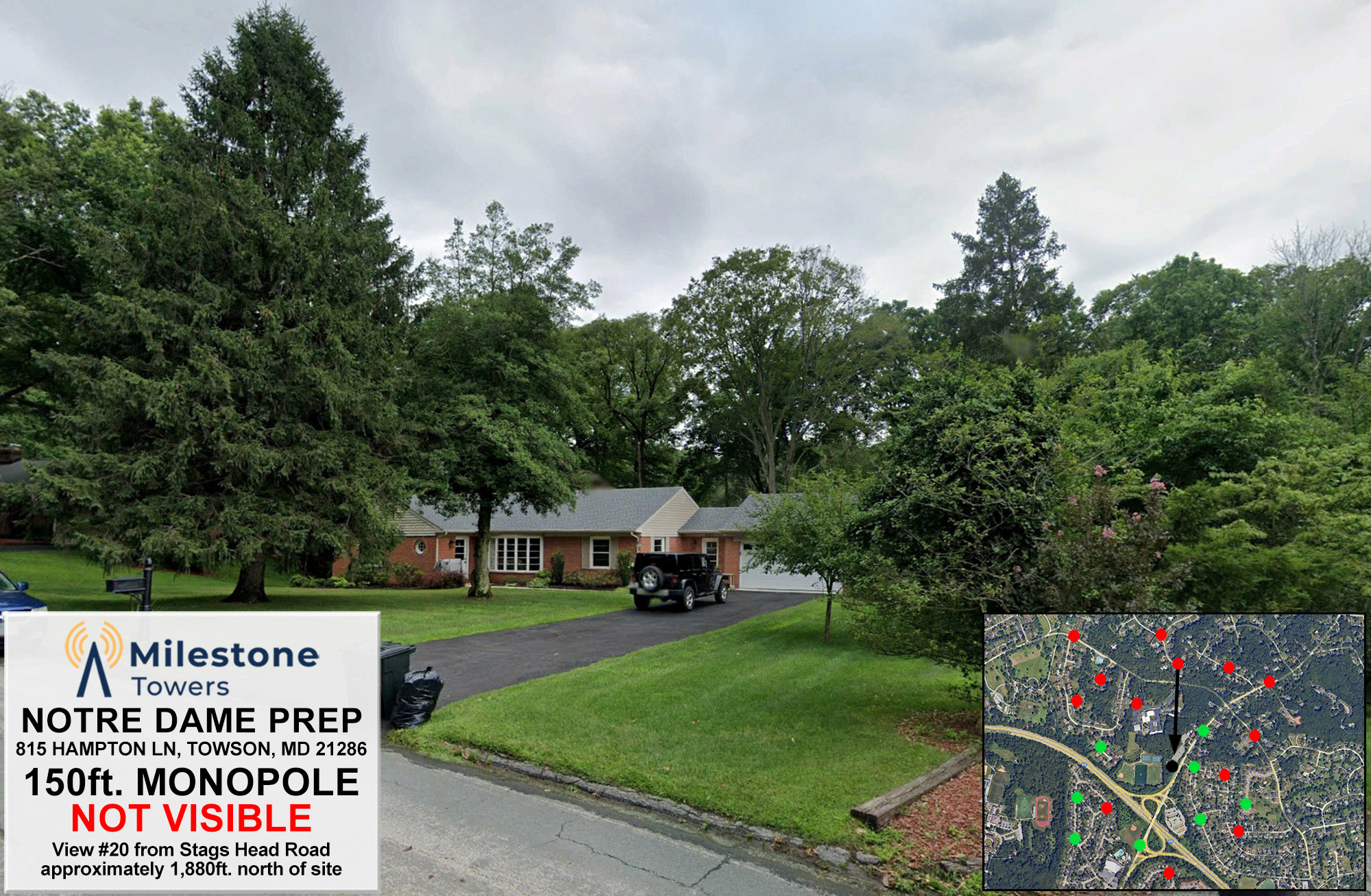
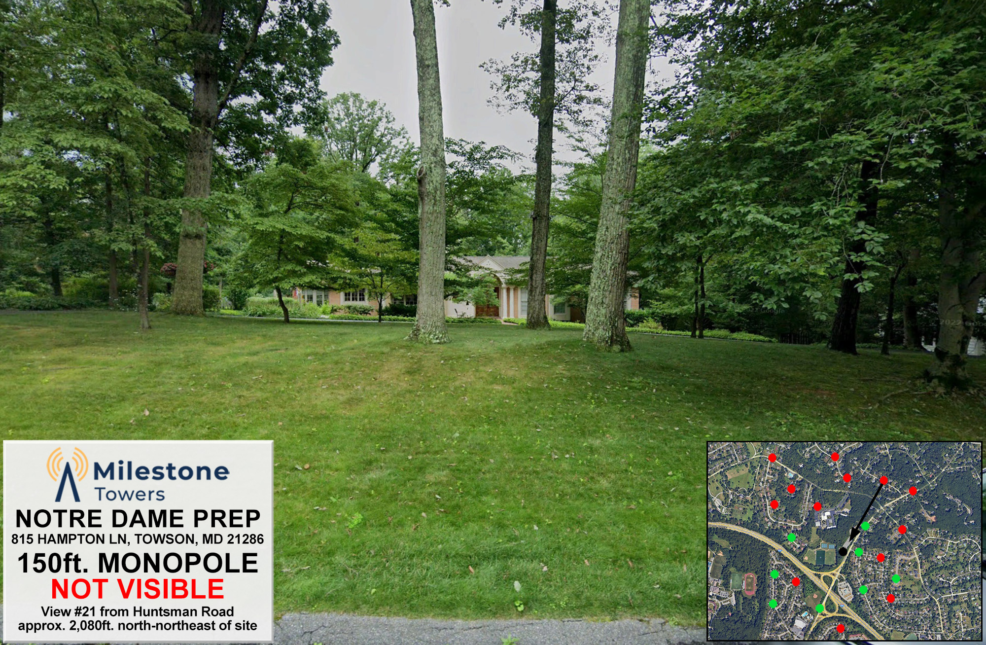
Understandably, communities want to know what a new facility will look like in their neighborhood. Photo simulations were created using lidar models and 3D maps of the tower location and surrounding environment in conjunction with 3D software and compositing software to superimpose a 150-foot monopole from a number of locations in the surrounding neighborhoods. The photo simulations below show how the proposed facility would look from these various vantage points..